
GIS Is Data—GEOINT Is Intelligence: A Better Approach to Farmland Analysis
This paper builds on our introduction to AgInt™, Scythe & Spade’s framework for combining technology, data, and practical expertise to turn complex agricultural information into actionable intelligence. Here, we focus on one of its core disciplines—geospatial intelligence (GEOINT)—and examine how it moves GIS beyond mapping to support better farmland investment and asset management decisions.
From GIS to GEOINT: Without Layering Other Sources of Intelligence and Proper Analysis, GIS Mapping Information is Just Data
Most people think of GIS as maps, layers, and data. That’s not wrong—but it’s incomplete. In farmland investing and management, the hardest problems we face aren’t cartographic, they are intelligence problems.
Ownership is fragmented across LLCs and aliases; operational reality lags public records; conditions change faster than reports update; and critical information is often incomplete, inconsistent, or intentionally obscured. That’s not a clean data environment easily summarized with geographical references or maps. This is an environment where multi-faceted intelligence is necessary.
GIS answers where.
GEOINT answers what’s really going on and where.
Traditional GIS organizes geographic data; Geospatial Intelligence (GEOINT) turns imperfect signals into decision-ready insight. That means combining: ISR (Imagery & Sensors), satellite imagery (LiDAR, soils, water data, time‑series indicators), HUMINT (Human Observations through field visits, operator conversations, local networks), and OSINT (Open Signals public records, market activity, digital exhaust). But technology alone doesn’t solve the problem.
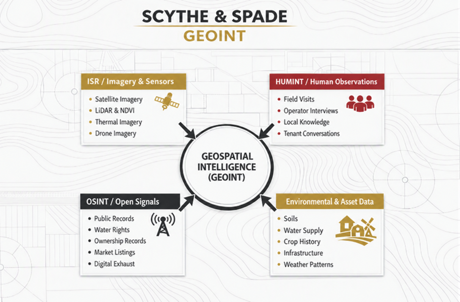
Intelligence is not about certainty. It’s about confidence.
GeoINT is one facet of Scythe & Spade’s AgInt™ way of thinking; AgInt™ being the process of combining technology, data, and our teams’ diverse expertise to simplify complex problems in agricultural investments and asset management. GeoINT works hand in hand with HumINT (Human Intelligence) and SigINT (Market Signal Intelligence) to build confidence in the decisions that must be made. This interplay between these different intelligences is integral to capitalizing on the full potential of GIS and GeoINT. GeoINT can cluster entities, surface anomalies, and accelerate discovery—but it cannot assign intent, assess commodity risks, or negotiate reality on the ground. That’s where human judgment (HumINT) and market awareness (SigINT) remains irreplaceable. A vegetation index through LIDAR technology can tell you something changed. A field visit can tell you why it matters, and a market analyst’s judgment helps determine the options for what to do next.
The shift isn’t “more tech.”
It’s better framing.
When farmland analysis is treated as an intelligence problem: hypotheses are explicit; alternatives are considered; confidence is graded; and decisions are traceable. Maps become tools—not conclusions.
This GEOINT framing doesn’t replace GIS. It elevates it—from a system that organizes data to one that supports real decisions under uncertainty. In agriculture, the question is rarely “What does the map say?” It’s “What does this actually mean for the asset?” That’s an intelligence question—and it deserves an intelligence approach.
GeoINT also builds in efficiencies and reduces the time needed to make decisions. Utilizing these GeoINT technologies we often uncover issues in boundaries, acreage, crop production, water distribution, and more that would often be missed in on-farm reviews. These leads can then be more easily chased down by our team to either be resolved or mitigated.
Below are some real examples of how Scythe & Spade’s AgINT™ way of thinking elevated GIS tools to GeoINT.
Example 1:
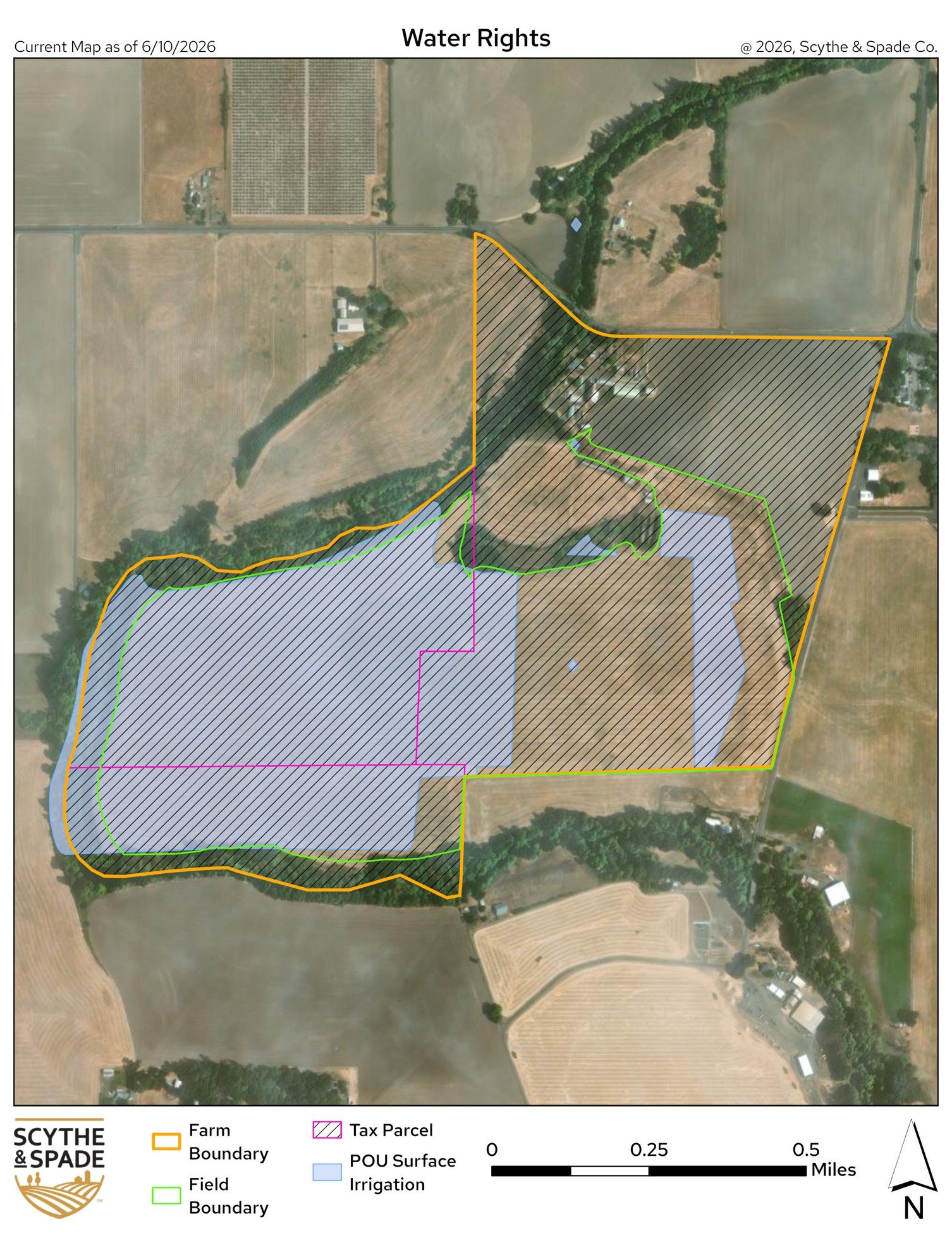
The map below shows a farm with water rights data from an established commercial source. As one can see, the water area is only shown the portion of the farm shaded in light purple marked as “POU Surface Irrigation”. What does this mean? Is the data correct, and only a portion of the farm includes water rights? Or is the data incorrect? A lack of water would limit what crops can be grown on this subject property and ultimately the earning potential of the farm.
However, after consulting with the local and state water resources, our regional representatives and GIS analyst found that this data layer source was inaccurate; a data layer error with significant operational valuation implications.
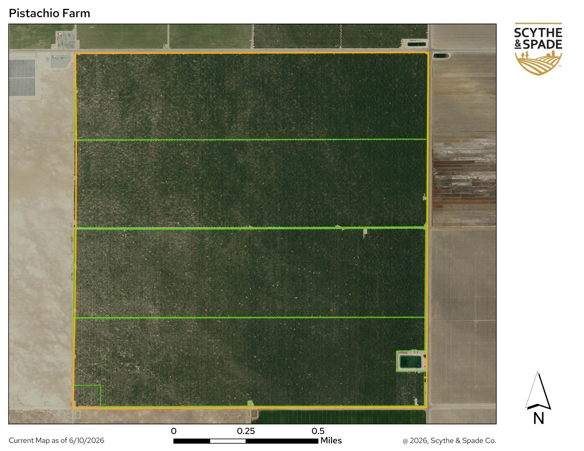
Example 2 A: Pistachio Farm
At a glance, this map provides overhead imagery that shows a mature pistachio farm. However, looking more closely, one may see the unevenness in the color variation of the farm. Imagery can only show so much. An on-site evaluation adds the HumInt (Human Intelligence) perspective that could then verify or exclude primary and secondary causes.
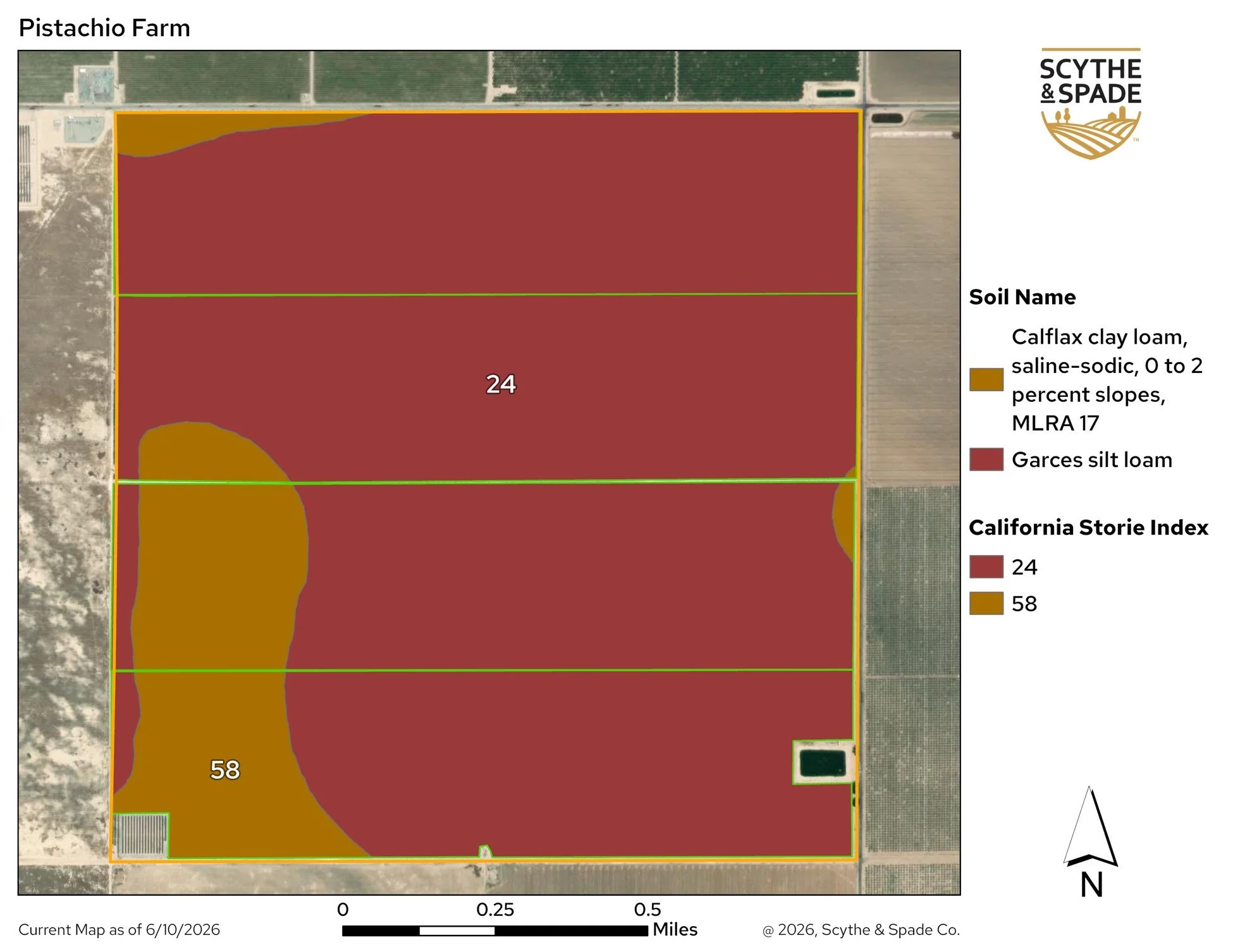
Example 2 B: Soil Index
The map below shows the soils on the same farm, including its rank on the California Storie Index. While visually stunning, this map still needs an understanding of what the Storie Index conveys, a historic reference of what crops have and will be planted, and a broad understanding of the availability and quality of irrigation water before this map can drive decisions on how this property can best be valued and managed as an asset. Once again the HumInt interaction with the GeoInt working together drives the value and actionability to intelligence information.
In summary, GeoINT elevates the ability of GIS technology to build intelligence into the broader picture of agriculture’s most complex issues. In our next two articles, we will turn our attention to how Human Intelligence (HumINT) and Market Signal Intelligence (SigINT) further contribute to the AgInt approach.